Category:German-language maps
Jump to navigation
Jump to search
Please place all maps in German in this category.
Subcategories
This category has the following 40 subcategories, out of 40 total.
- German-language map legends (30 F)
- German-language maps of Africa (79 F)
A
- Atlas Tyrolensis (33 F)
B
C
- Chorographia Bavariae (2 F)
D
- Deutscher Schulatlas 1943 (8 F)
F
- Maps by Carl Flemming (2 F)
- Flemmings Kriegskarten (67 F)
G
L
- Lange-Diercke Sachsen (1 P, 115 F)
M
P
- Platt's großer Atlas der Erde (74 F)
S
V
- Voege-Plan (2 F)
- Vosges in the 1890s (5 F)
W
- Warmund Ygl's map of Tyrol (7 F)
Media in category "German-language maps"
The following 200 files are in this category, out of 717 total.
(previous page) (next page).png/120px-086_sibirien_(1905).png) 086 sibirien (1905).png 2,220 × 1,763; 2.6 MB
086 sibirien (1905).png 2,220 × 1,763; 2.6 MB
.jpg/99px-08Aug_Sofi_global_(farbig).jpg) 08Aug Sofi global (farbig).jpg 1,366 × 1,659; 312 KB
08Aug Sofi global (farbig).jpg 1,366 × 1,659; 312 KB
.jpg/93px-121_of_%27Reisen_und_Jagden_in_Nord-Ost-Afrika%2C_1864-1865%27_(11082024626).jpg) 121 of 'Reisen und Jagden in Nord-Ost-Afrika, 1864-1865' (11082024626).jpg 1,543 × 1,980; 429 KB
121 of 'Reisen und Jagden in Nord-Ost-Afrika, 1864-1865' (11082024626).jpg 1,543 × 1,980; 429 KB
.jpg/120px-158_of_%27In_die_Vogesen%21_..._Mit_68_Bildern_von_J._Weber%2C_etc%27_(11205876423).jpg) 158 of 'In die Vogesen! ... Mit 68 Bildern von J. Weber, etc' (11205876423).jpg 2,465 × 2,265; 1.27 MB
158 of 'In die Vogesen! ... Mit 68 Bildern von J. Weber, etc' (11205876423).jpg 2,465 × 2,265; 1.27 MB
.jpg/120px-159_of_%27In_die_Vogesen%21_..._Mit_68_Bildern_von_J._Weber%2C_etc%27_(11204774114).jpg) 159 of 'In die Vogesen! ... Mit 68 Bildern von J. Weber, etc' (11204774114).jpg 2,478 × 2,251; 1.28 MB
159 of 'In die Vogesen! ... Mit 68 Bildern von J. Weber, etc' (11204774114).jpg 2,478 × 2,251; 1.28 MB
 1760 Bellin Map of Bali, Indonesia - Geographicus - Bali-bellin-1760.jpg 2,668 × 2,097; 932 KB
 1790 map of Tibet.jpg 10,927 × 7,670; 13.23 MB
%27_(11219718116).jpg/120px-182_of_%27(Italy_and_her_Invaders%2C_Vol._1-4.)%27_(11219718116).jpg) 182 of '(Italy and her Invaders, Vol. 1-4.)' (11219718116).jpg 2,352 × 1,468; 701 KB
182 of '(Italy and her Invaders, Vol. 1-4.)' (11219718116).jpg 2,352 × 1,468; 701 KB
 1845 map - Neueste Karte der Küstenländer des Schwarzen Meeres.jpg 11,510 × 9,236; 19.18 MB
 1848 map of Central Asia by Heinrich Kiepert.jpg 11,845 × 14,157; 23.39 MB
 1880 Perthes - Stieler Map of the Moon - Geographicus - Moon-stieler-1870.jpg 4,000 × 3,417; 3.22 MB
 Karte Kyffhäuser.jpg 748 × 1,009; 571 KB
 1913 - Die alte Verbindung zwischen dem Oxus und dem Kaspischen Meer.jpg 3,885 × 3,186; 1.65 MB
 1942 German military map - Syrien - Amouk.jpg 16,301 × 17,607; 35.02 MB
 1942 German military map - Ägypten - Baltim.jpg 14,025 × 15,373; 30.1 MB
 2011 Oslo attacks map deutsch.png 642 × 555; 172 KB
 2021-03-29 Wendezeller Ring 02.JPG 1,563 × 2,344; 1.62 MB
 Acher-Rench-Korrektion-Übersicht.jpg 2,124 × 2,936; 1,016 KB
 Aegean Sea map-de.png 2,079 × 2,530; 979 KB
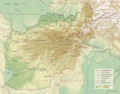 Afghanistan physisch.png 1,622 × 1,266; 3.26 MB
.jpg/120px-Afghanistan_und_seine_Nachbarländer_-_btv1b530277215_(1_of_3).jpg) Afghanistan und seine Nachbarländer - btv1b530277215 (1 of 3).jpg 9,215 × 7,857; 16.95 MB
Afghanistan und seine Nachbarländer - btv1b530277215 (1 of 3).jpg 9,215 × 7,857; 16.95 MB
 Akadisches Franzoesisch.png 1,180 × 824; 433 KB
 Albanien BV042751247.jpg 4,390 × 3,450; 2.59 MB
 Alpenregionen.png 2,000 × 1,472; 428 KB
 Alpenvorland.jpg 547 × 289; 34 KB
 Alpes.jpg 1,108 × 724; 233 KB
 Alptransit Gotthardachse.png 807 × 726; 441 KB
.jpg/120px-Alsace_(Specklin%2C_1576).jpg) Alsace (Specklin, 1576).jpg 13,791 × 4,544; 15.02 MB
Alsace (Specklin, 1576).jpg 13,791 × 4,544; 15.02 MB
 Alsace-Lorraine Dialectes-de.png 1,496 × 2,621; 511 KB
 Alte Salzstraße durch Sprottischwaldau.jpg 1,694 × 461; 358 KB
 Amami Islands-de.png 1,500 × 1,540; 391 KB
 Amami Islands-de2.png 1,500 × 1,540; 392 KB
 Amazonaskarte Bry 1599.jpg 1,982 × 1,489; 1.43 MB
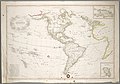
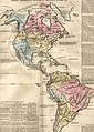 Amerika- historisch, physisch und politisch im Jahr 1828.jpg 3,654 × 5,136; 3.48 MB
 Amerika.jpg 9,917 × 6,963; 18.24 MB
 Analepsis 3.jpg 1,154 × 740; 213 KB
 Andorra.png 330 × 354; 8 KB
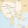 Angkor Kambodscha Karte.png 527 × 522; 47 KB
 Anglo-Dutch-War-2b.png 2,242 × 1,605; 430 KB
 AngloDutchWarGer1.png 3,049 × 1,833; 687 KB
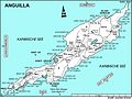 Anguilla map.jpg 1,879 × 1,408; 865 KB
 Antigua map.jpg 1,949 × 1,354; 1.14 MB
 Antipodenkarte4.jpg 1,424 × 914; 209 KB
 Arabische Liga-2.png 1,000 × 901; 237 KB
 Arabische Liga.png 1,000 × 901; 168 KB
 Aralsee tr.gif 560 × 819; 279 KB
 Aralsee.gif 558 × 817; 94 KB
.jpg/77px-Arbeitslager_Workuta_(Lageskizze).jpg) Arbeitslager Workuta (Lageskizze).jpg 1,662 × 2,568; 900 KB
Arbeitslager Workuta (Lageskizze).jpg 1,662 × 2,568; 900 KB
 ARG Pipeline Karte.jpg 372 × 235; 43 KB
 Arktik-Karte.png 329 × 330; 18 KB
 Arktischer Ozean.png 300 × 301; 76 KB
 Asowsches Meer.jpg 1,015 × 571; 81 KB
 Aussig 1936 I.jpg 6,800 × 4,677; 3.47 MB
 Aussig 1936 II.jpg 6,800 × 4,677; 3.68 MB
 Aussig 1936 III.jpg 6,800 × 4,672; 4.12 MB
 Aussig 1936 IV.jpg 6,800 × 4,672; 4.02 MB
 Aussig 1936.jpg 9,201 × 7,237; 7.97 MB
 Australien 1905.png 1,800 × 1,508; 1.67 MB
 Avalonia entwicklung odovizium silur.png 708 × 1,601; 34 KB
 Baalbek by Puchstein.png 1,888 × 3,052; 1.74 MB
 Barents sea map de.png 1,188 × 1,085; 252 KB
 Barrandium katzer 1891.jpg 2,671 × 2,435; 926 KB
 Belgien1953.png 700 × 615; 187 KB
 Berestia, 1917, map.jpg 756 × 756; 391 KB
 Berezhky, 1917, map.jpg 940 × 940; 558 KB
 Berezhnytsia, 1917, map.jpg 988 × 988; 549 KB
 Bergkarabach Schuschi Deutsch.png 356 × 518; 51 KB
 Bertung Allenstein 1914.jpg 1,766 × 1,621; 1.51 MB
 BielensteinLettgallenSemgallenKurenLiven1250.jpg 4,718 × 4,180; 3.59 MB
%2C_1917%2C_map.jpg/120px-Bila_Station_(Bile)%2C_1917%2C_map.jpg) Bila Station (Bile), 1917, map.jpg 595 × 595; 225 KB
Bila Station (Bile), 1917, map.jpg 595 × 595; 225 KB
 Bila, 1917, map.jpg 523 × 523; 185 KB
 Black Sea and the Caucasus, 1852 г..jpg 2,975 × 2,165; 9.35 MB
 Bodleian Libraries, Sebastian Munster, La table des Isles neufues.jpg 1,000 × 675; 164 KB
.jpg/120px-Botel_Tobago_Insel_(Karte_1905).jpg) Botel Tobago Insel (Karte 1905).jpg 401 × 401; 48 KB
Botel Tobago Insel (Karte 1905).jpg 401 × 401; 48 KB
 BPE-Lageplan.jpg 820 × 1,025; 162 KB
 Brabantisch.PNG 844 × 1,532; 57 KB
 Britische Inseln.jpg 5,727 × 6,892; 13.38 MB
_(14781481045).jpg/73px-Brockhaus%27_Konversations-Lexikon_(1892)_(14781481045).jpg) Brockhaus' Konversations-Lexikon (1892) (14781481045).jpg 1,558 × 2,566; 702 KB
Brockhaus' Konversations-Lexikon (1892) (14781481045).jpg 1,558 × 2,566; 702 KB
 Brodets, 1917, map.jpg 790 × 790; 468 KB
 Budymlia, 1917, map.jpg 1,029 × 1,029; 566 KB
.jpg/120px-Bukan_map_1918(1297).jpg) Bukan map 1918(1297).jpg 969 × 814; 1.39 MB
Bukan map 1918(1297).jpg 969 × 814; 1.39 MB
 BV017048106.jpg 6,458 × 6,833; 5.64 MB
 1581 Bunting clover leaf map.jpg 4,441 × 3,496; 14.36 MB
 Californian Channel Islands map de.png 1,200 × 1,019; 240 KB
 Canton Rohrbach-les-Bitche.jpg 5,983 × 5,977; 19.75 MB
.jpg/120px-Carte_von_dem_Hafen_und_der_Stadt_Boston_(2675343222).jpg) Carte von dem Hafen und der Stadt Boston (2675343222).jpg 2,000 × 1,724; 3.29 MB
Carte von dem Hafen und der Stadt Boston (2675343222).jpg 2,000 × 1,724; 3.29 MB
 Caucasus-ethnic de 150dpi.png 1,000 × 1,136; 373 KB
 Chaim Solomon Pinia. Panorama des heiligen Landes. 1875.jpg 2,814 × 2,200; 1.33 MB
 Charte Feldzüge 1805.jpg 2,054 × 1,585; 2.87 MB
 Charte von West-Indien oder den Atillischen Inseln.jpg 3,478 × 2,513; 1.34 MB
 Chemin de fer Franco-Hellenique.png 5,027 × 5,748; 3.21 MB
 Chichen Itza Monjas Plan DE.jpg 2,975 × 1,485; 354 KB
 Cimarrones und Reiterkulturen in Südamerika.png 403 × 671; 147 KB
 Colonia Agricola Santa Maria - 1, Acervo do Museu Paulista da USP.jpg 7,216 × 5,412; 21.38 MB
_p_051.jpg/120px-Cosmographia_(Sebastian_Münster)_p_051.jpg) Cosmographia (Sebastian Münster) p 051.jpg 2,000 × 1,580; 541 KB
Cosmographia (Sebastian Münster) p 051.jpg 2,000 × 1,580; 541 KB
_p_063.jpg/120px-Cosmographia_(Sebastian_Münster)_p_063.jpg) Cosmographia (Sebastian Münster) p 063.jpg 2,000 × 1,571; 565 KB
Cosmographia (Sebastian Münster) p 063.jpg 2,000 × 1,571; 565 KB
_p_075.jpg/120px-Cosmographia_(Sebastian_Münster)_p_075.jpg) Cosmographia (Sebastian Münster) p 075.jpg 2,000 × 1,530; 528 KB
Cosmographia (Sebastian Münster) p 075.jpg 2,000 × 1,530; 528 KB
_p_078.jpg/120px-Cosmographia_(Sebastian_Münster)_p_078.jpg) Cosmographia (Sebastian Münster) p 078.jpg 2,000 × 1,525; 556 KB
Cosmographia (Sebastian Münster) p 078.jpg 2,000 × 1,525; 556 KB
_p_087.jpg/120px-Cosmographia_(Sebastian_Münster)_p_087.jpg) Cosmographia (Sebastian Münster) p 087.jpg 2,000 × 1,518; 501 KB
Cosmographia (Sebastian Münster) p 087.jpg 2,000 × 1,518; 501 KB
_p_090.jpg/120px-Cosmographia_(Sebastian_Münster)_p_090.jpg) Cosmographia (Sebastian Münster) p 090.jpg 2,000 × 1,518; 549 KB
Cosmographia (Sebastian Münster) p 090.jpg 2,000 × 1,518; 549 KB
_p_099.jpg/120px-Cosmographia_(Sebastian_Münster)_p_099.jpg) Cosmographia (Sebastian Münster) p 099.jpg 2,000 × 1,455; 486 KB
Cosmographia (Sebastian Münster) p 099.jpg 2,000 × 1,455; 486 KB
_p_108.jpg/120px-Cosmographia_(Sebastian_Münster)_p_108.jpg) Cosmographia (Sebastian Münster) p 108.jpg 2,000 × 1,455; 495 KB
Cosmographia (Sebastian Münster) p 108.jpg 2,000 × 1,455; 495 KB
_p_123.jpg/120px-Cosmographia_(Sebastian_Münster)_p_123.jpg) Cosmographia (Sebastian Münster) p 123.jpg 2,000 × 1,455; 478 KB
Cosmographia (Sebastian Münster) p 123.jpg 2,000 × 1,455; 478 KB
 Course Channeltunnel de.png 472 × 387; 19 KB
 Cranach israel map.jpg 2,565 × 2,256; 1.26 MB
.JPG/120px-Creta_(religions_in_1897).JPG) Creta (religions in 1897).JPG 3,150 × 2,538; 1.42 MB
Creta (religions in 1897).JPG 3,150 × 2,538; 1.42 MB
 Cyclades map names de.PNG 486 × 444; 78 KB
 Dahner Felsenland Karte.png 1,200 × 989; 1.42 MB
 Darién Lücke.png 366 × 376; 10 KB
 Das Heilig Jüdischlandt mit außchulung der wolff geschlechter.jpg 8,759 × 6,808; 17.74 MB
 Das Heilig Landt mit Auftheilung der zwolff Geschlechter.jpg 8,944 × 7,889; 17.92 MB
 Das Mittelländische Meer Und Nord-Afrika.jpg 5,652 × 4,701; 10.51 MB
 Das Mittelländische und Schwarze Meer Nebst Übersicht Der Länder Des Osmanischen Reichs.jpg 5,607 × 4,581; 8.62 MB
 Das Reich der Liebe - Zweyter Landchartensatz-Versuch.jpg 1,886 × 1,443; 3.45 MB
 Datumsgrenze MK1888.png 337 × 458; 29 KB
 Dbs.JPG 1,287 × 1,297; 1.28 MB
 Dead sea german.jpg 292 × 481; 68 KB
 Deeside Line.svg 2,012 × 741; 3.65 MB
 Deister.jpg 496 × 417; 146 KB
 Delaware01.png 1,182 × 1,387; 473 KB
 Der Atlantische Ocean.jpg 5,607 × 4,567; 6.62 MB
%2C_1941.jpg/120px-Der_vordere_Orient_(Proche-Orient)%2C_1941.jpg) Der vordere Orient (Proche-Orient), 1941.jpg 1,568 × 1,023; 2.12 MB
Der vordere Orient (Proche-Orient), 1941.jpg 1,568 × 1,023; 2.12 MB
 Der Weg des "Marsianers"- Bild der Marssonde Mars Express.jpg 2,082 × 1,666; 2.26 MB
 Description of the Holy Land WDL2891.png 1,322 × 1,024; 2.54 MB
 Detailkarte der Gräben in Sankt Andreasberg.jpg 6,438 × 4,293; 6.87 MB
 Deutschösterreich und Schweiz.jpg 771 × 627; 69 KB
 DHI UK 2016 EUSILC.svg 512 × 493; 157 KB
 Die ersten europäischen Siedlungen in Amerika.png 1,500 × 677; 1.21 MB
_b_372.jpg/120px-Die_Gartenlaube_(1859)_b_372.jpg) Die Gartenlaube (1859) b 372.jpg 3,057 × 2,000; 2.85 MB
Die Gartenlaube (1859) b 372.jpg 3,057 × 2,000; 2.85 MB
_b_051_2.jpg/106px-Die_Gartenlaube_(1890)_b_051_2.jpg) Die Gartenlaube (1890) b 051 2.jpg 1,177 × 1,336; 663 KB
Die Gartenlaube (1890) b 051 2.jpg 1,177 × 1,336; 663 KB
 Die Neuwen Inseln so hinder Hispanica gegen Orient bey dem Landt Indie ligen. NYPL434937.tiff 5,595 × 4,880; 78.12 MB
_109.jpg/77px-Die_Portugiesenzeit_(Strandes)_109.jpg) Die Portugiesenzeit (Strandes) 109.jpg 1,165 × 1,800; 376 KB
Die Portugiesenzeit (Strandes) 109.jpg 1,165 × 1,800; 376 KB
 Die Umgebung von St. Andreasberg in der 2. Hälfte des 17. Jahrhunderts.jpg 7,072 × 4,938; 6.47 MB
 Die Völker und Reiche der Slaven zwichen Elbe und Don bis 1125.jpg 5,008 × 3,498; 12.21 MB
 Diemersteiner Wald Karte.png 1,200 × 989; 1.42 MB
 Dinarisches Gebirge Topo.png 2,900 × 2,250; 7.61 MB
 Dnepr Kiew Reservoir.png 410 × 475; 88 KB
 Dnieper Basin River Town German 2.png 1,180 × 1,214; 395 KB
 Dnieper Basin River Town German.png 1,180 × 1,214; 396 KB
 Drawehn.png 775 × 909; 76 KB
 Drehstromuebertragung Lauffen-Frankfurt.png 615 × 1,332; 1.31 MB
 Dubrovytsia, 1917, map.jpg 1,066 × 1,066; 734 KB
 Durban trsp.gif 266 × 190; 12 KB
 Durchgehender Altrheinzug - Skizze.tif 618 × 1,266; 3.02 MB
 Eastern Front 1943-02 to 1943-08 de.png 1,201 × 921; 249 KB
 Ebro spanien.png 771 × 507; 240 KB
 Einzugsgebietskarte Nahe.png 2,909 × 2,772; 12.73 MB
 Eisenbahnzugänge zum Harz.png 1,634 × 1,095; 2.7 MB
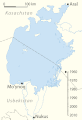
 Elbe Einzugsgebiet.png 1,309 × 1,381; 1.96 MB
 Elbe basin.png 1,309 × 1,381; 1.8 MB
 Spree-Havel in Elbe basin.png 1,309 × 1,381; 1.79 MB
 Elbingerode – Schirke – Tanne.png 3,316 × 1,761; 11.18 MB
 Elm-Asse-Karte.png 739 × 591; 364 KB
 Enclave de.png 292 × 200; 2 KB
.png/120px-Eratosthenes_world_map_(German_text).png) Eratosthenes world map (German text).png 1,040 × 610; 155 KB
Eratosthenes world map (German text).png 1,040 × 610; 155 KB
 Erdfunkstelle Fuchsstadt.PNG 2,910 × 2,439; 197 KB
 ETH302 Accident Flight.gif 540 × 540; 11 KB
 Euro2008 Spielorte.png 660 × 300; 4 KB
.jpg/120px-Europa_die_erste%2C_Tafel_des_Ersten_Buchs%2C_Johannes_Stumpf_(Zürich%2C_1548-50).jpg) Europa die erste, Tafel des Ersten Buchs, Johannes Stumpf (Zürich, 1548-50).jpg 2,500 × 1,880; 3.38 MB
Europa die erste, Tafel des Ersten Buchs, Johannes Stumpf (Zürich, 1548-50).jpg 2,500 × 1,880; 3.38 MB
 Europäische Wasserscheiden Ostsee.png 459 × 419; 129 KB
 Europäisches Nordmeer mit Grenzen.png 989 × 901; 441 KB
 F. L. Güssefeld, Map of North America, 1784.jpg 7,557 × 6,176; 13.58 MB
 Fallstein-Huy-Karte.png 908 × 715; 527 KB
 FF 1988 Streckenplan.JPG 760 × 606; 50 KB
 FF 1989 Streckenplan.JPG 760 × 413; 39 KB
 Flugziele Nurnberg Marienberg.png 2,091 × 1,398; 242 KB
 Frankenweide Karte.png 1,200 × 989; 1.42 MB
 Frankfurt-Main Airport Map DE.png 2,253 × 1,890; 1.53 MB
 Franzius Unterweser r90.jpg 2,160 × 1,407; 2.23 MB
 Franzius Unterweser.jpg 2,160 × 1,407; 2.36 MB
 FranzJosefLand1.gif 350 × 306; 119 KB
.JPG/120px-Friedhöfe_LA_Lageplan_gesamt_2012-04-23_ama_fec_(21).JPG) Friedhöfe LA Lageplan gesamt 2012-04-23 ama fec (21).JPG 2,103 × 1,382; 824 KB
Friedhöfe LA Lageplan gesamt 2012-04-23 ama fec (21).JPG 2,103 × 1,382; 824 KB
 Fränkische Alb DE.png 1,015 × 1,228; 1.94 MB
 Funafuti 2022.png 5,000 × 6,188; 1.28 MB
 Fürstentum Halberstadt-Abtei Quedlinburg.jpg 2,940 × 1,912; 3.83 MB
 Gegeichnet von I.C.M. Reinecke. Ganscha. 1804.jpg 2,033 × 968; 320 KB
 Gegeichnet von I.C.M. Reinecke. Gebiet des Berközen Uzmey. 1804.jpg 1,129 × 638; 166 KB
 Gegeichnet von I.C.M. Reinecke. Georgie. 1804.jpg 2,354 × 2,462; 1.04 MB
 Gegeichnet von I.C.M. Reinecke. Guriel. 1804.jpg 1,682 × 874; 256 KB
 Gegeichnet von I.C.M. Reinecke. Imerette-2. 1804.jpg 1,619 × 988; 329 KB
.png)
.jpg)
.jpg)
.jpg)
.jpg)
.jpg)
.jpg)
.jpg)
.jpg)
_-_Geographicus_-_CaspianKamchatka-homann-1725.jpg)


_-_Geographicus_-_NorthwestPassage-schraembl-1788.jpg)


%27_(11219718116).jpg)


.jpg)


.jpg)


,_1917,_map.jpg)


.jpg)


_(14781481045).jpg)


.jpg)


.jpg)


.jpg)

.jpg)
_p_051.jpg)
_p_063.jpg)
_p_075.jpg)
_p_078.jpg)
_p_087.jpg)
_p_090.jpg)
_p_099.jpg)
_p_108.jpg)
_p_123.jpg)


.JPG)


,_1941.jpg)


_b_372.jpg)
_b_051_2.jpg)
_(20928323685).jpg)
_109.jpg)


.jpg)
.jpg)


.png)


.jpg)


.JPG)


.jpg)